2017年7月、KYOTO Design Labは、国際赤十字委員会にて、医療や教育施設の建設を通じた人道支援に長年携わってきたサミュエル・ボネ氏らを招き、京都市中心部における災害対策のためのシナリオ・ライティング・ワークショップを実施した。訪日外国人観光客が増加する京都において、どのような問題が新たに顕在化しているのだろうか。また、この課題をどのように乗り越えることができるのだろうか。学際的な課題に取り組んだ本ワークショップに参加した、京都工芸繊維大学学部生の三木裕介によるレポートをお届けする。
Text: 三木裕介
新しい災害対策への船出
2011年の東日本大震災から6年が経ち、震災の記憶が薄れていく一方で、南海トラフ巨大地震などが予想されている。さらに、ゲリラ豪雨のような異常気象による自然災害と都市の関係ついて、対策を練っていかなければならないと指摘されている。京都は世界有数の観光地であり、多数の外国人観光客が訪れる。大通りを曲がると細長い路地が展開し、木造の歴史的建物が立ち並ぶ風景は、京都の特徴であるが、同時に災害時に多くの危険を生む可能性がある。
これからの京都で災害対策を考えるために、KYOTO Design Labは、国際赤十字委員会のサミュエル・ボネ氏をワークショップ・リーダーに迎え、大震災時における京都市内をフィールドとした悲観的なシナリオにおける被害状況下で、言語が通じず災害弱者となり得る外国人観光客を主人公とした、シナリオライティング形式のワークショップを行った。
2017年7月3日から7日までの5日間におよぶワークショップは、ボネ氏に加え、ボネ氏とともに国際赤十字で活動後、現在は日本赤十字九州国際看護大学で教鞭をとる小川里見准教授、高知大学教育研究部自然科学系農学部門より藤原拓教授、京都大学で水環境工学分野を研究する西村文武教授が講師に招かれ、多角的な議論が求められた。さらに、訪日外国人観光客の視点を得るために藤原研究室に所属するタイ人留学生も参加した。
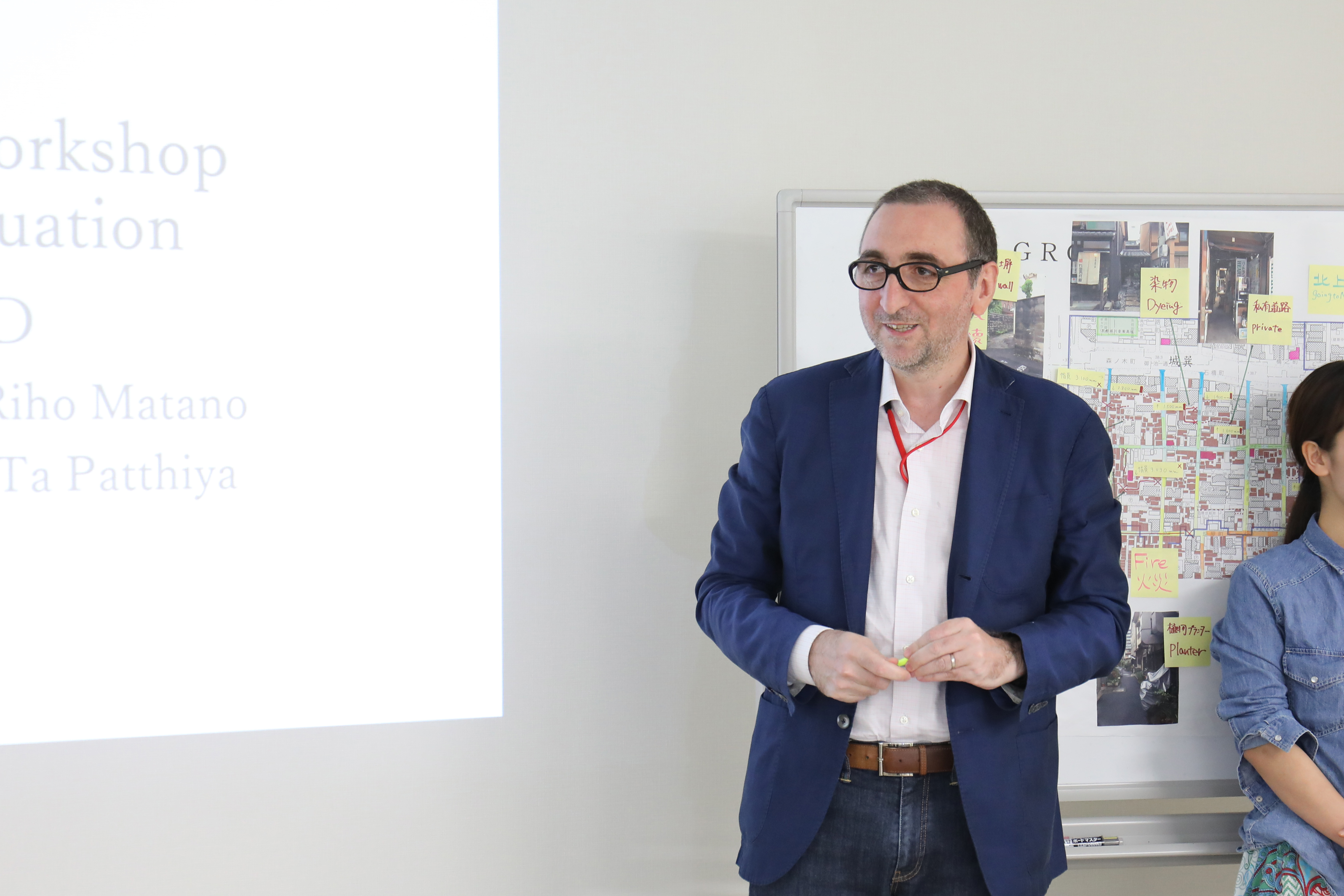
国際赤十字ではコソボなどの紛争地域における医療施設の設計施工チームのリーダーを努めていたボネ氏
実際に手足を動かしてみる
ワークショップ1、2日目は、外国人観光客の指定避難場所と地区ごとの避難場所まで避難する際にかかる時間や有効な道順を比較する「逃げ地図」の作成を行った。「逃げ地図」とは、日建設計ボランティア部(社内クラブ活動)が開発した避難経路や避難時間をおおまかに地図上へシミュレーションする方法だ。避難地形時間地図や諸データをもとに、徒歩での移動を原則とし、安全エリアまでの到達時間を地図上でシュミレーションし、避難にかかる時間別に色分けをする。地図上に徐々に浮かび上がってくるエリアの特徴に驚いたが、作成した逃げ地図を元に行った対象エリア内でのフィールドワークで、実物の都市の多様さにさらに驚かされた。地図には記入されていない道の起伏や鉢植えなどの造作物が都市には溢れている。ひとつひとつ素材やサイズは微妙に異なるが、多様な細部の集積によって都市全体が構成されているのだと実感した。各グループで道や建物などの寸法を測ったり、写真や気づきを地図へ詳細に記録したことが、具体的な提案の足がかりとなった。
さらに、フィールドワークの前に行われたボネ氏のレクチャーからは、紛争地域下の医療施設は、既存の建物を再利用し、迅速かつ最大の配慮を持って医療施設としての必要最低限の設備を揃えていくということを学んだ。紛争と災害という違いはあるけれど、「緊急性」というキーワードからたくさんのヒントを得ることができた。
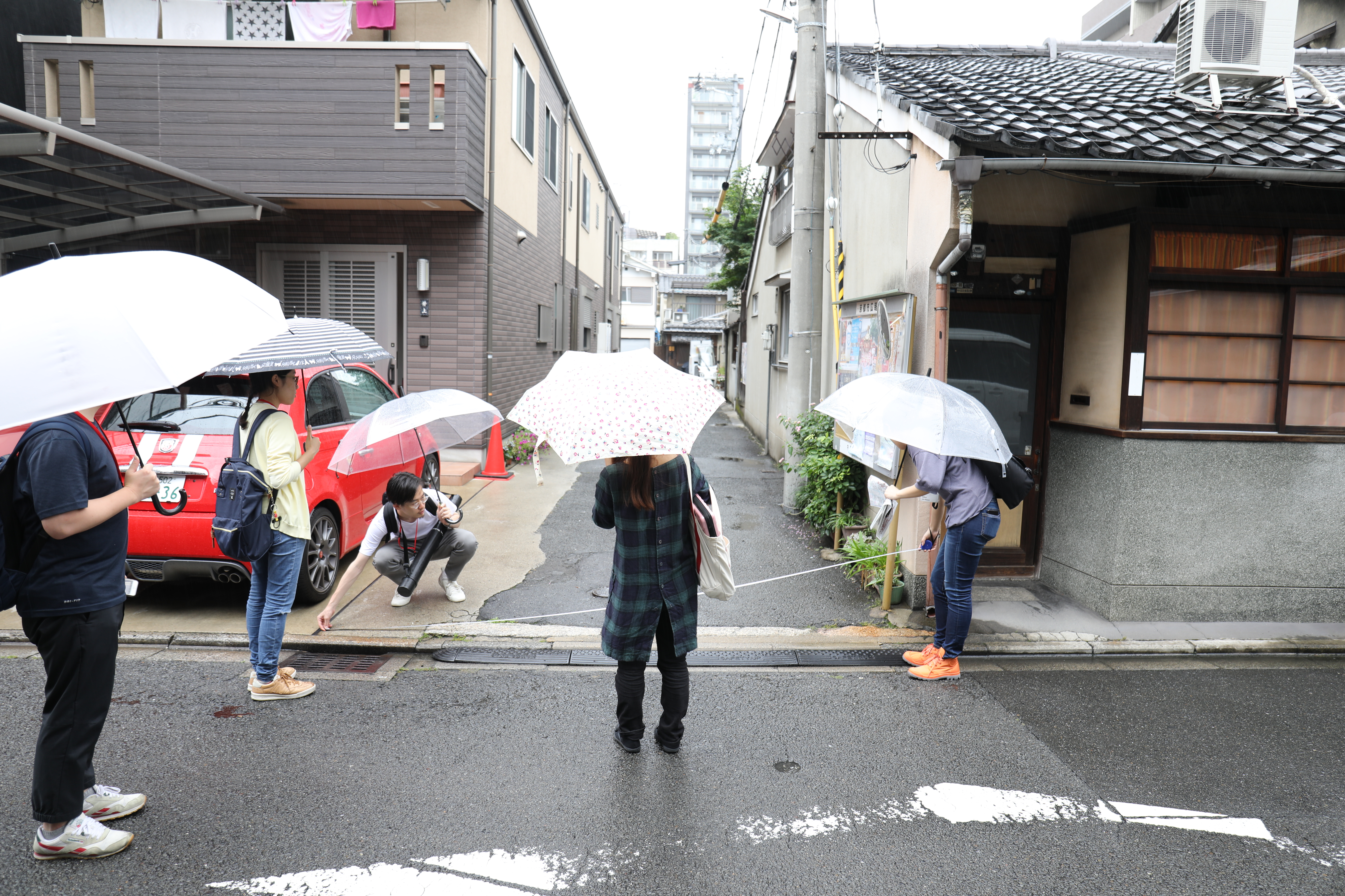
小雨が降る中で行われたフィールドワークの様子
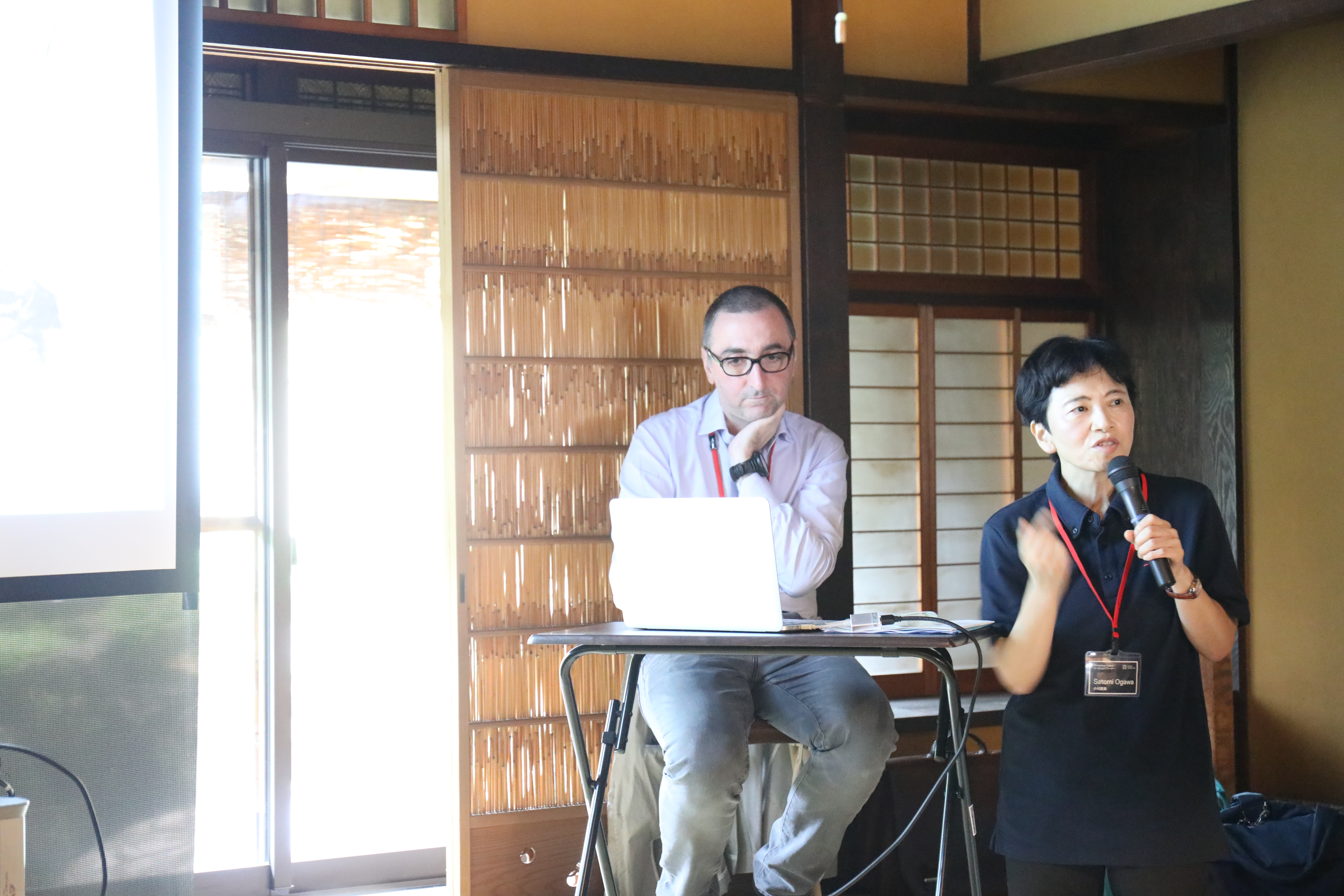
レクチャーで国際赤十字での活動を紹介するサミュエル・ボネ氏(左)小川里美氏(右)
「今あるもの」こそアイディアの宝庫
これらをもとに最終日のプレゼンテーションでは、特に避難時における安全かつ迅速な避難誘導について各グループから提案が発表された。既存の百貨店の屋上や駐車場などを避難場所として使うための設計や計画、サインの見直しをする提案。大通りを走るバスやタクシーといった公共交通に一時的な避難誘導灯と災害インフォメーションセンターの機能を持ち合わせる提案。さらには避難経路と時間をチェックできる携帯アプリや、地域独自の文化である鍾馗(しょうき)さんから災害時の揺れを感知して避難誘導灯を照射・人々を導く提案などが挙げられた。
ほとんどすべての案に統一していたことは、すでに街中にあるものを活用し、誰にでもわかりやすい誘導を促すということだ。ゲスト講師から、既存のものであるからこそまちへ馴染みやすく、わかりやすさにつながるかもしれないという講評を受けた。特に公共交通の災害時の利用法提案については現実性もあり、これから具体的に検討すべきではないかという声も上がった。また、藤原教授やD-labラボラトリー長で水環境学会長でもある小野教授からは、災害時にける生活用水の確保について指摘を受けた。各班がトイレを含む衛生・風呂用の見直し、食事・飲料用の水の確保について議論を行っていたが、木造建築が多く建つ京都中心部では、消防用の水確保も必要とされる。あまり知られていないが、豊かな地下水を保持している京都において、今は姿が見られなくなった井戸水と同時に失われてしまったコミュニティーの復活についても議論された。
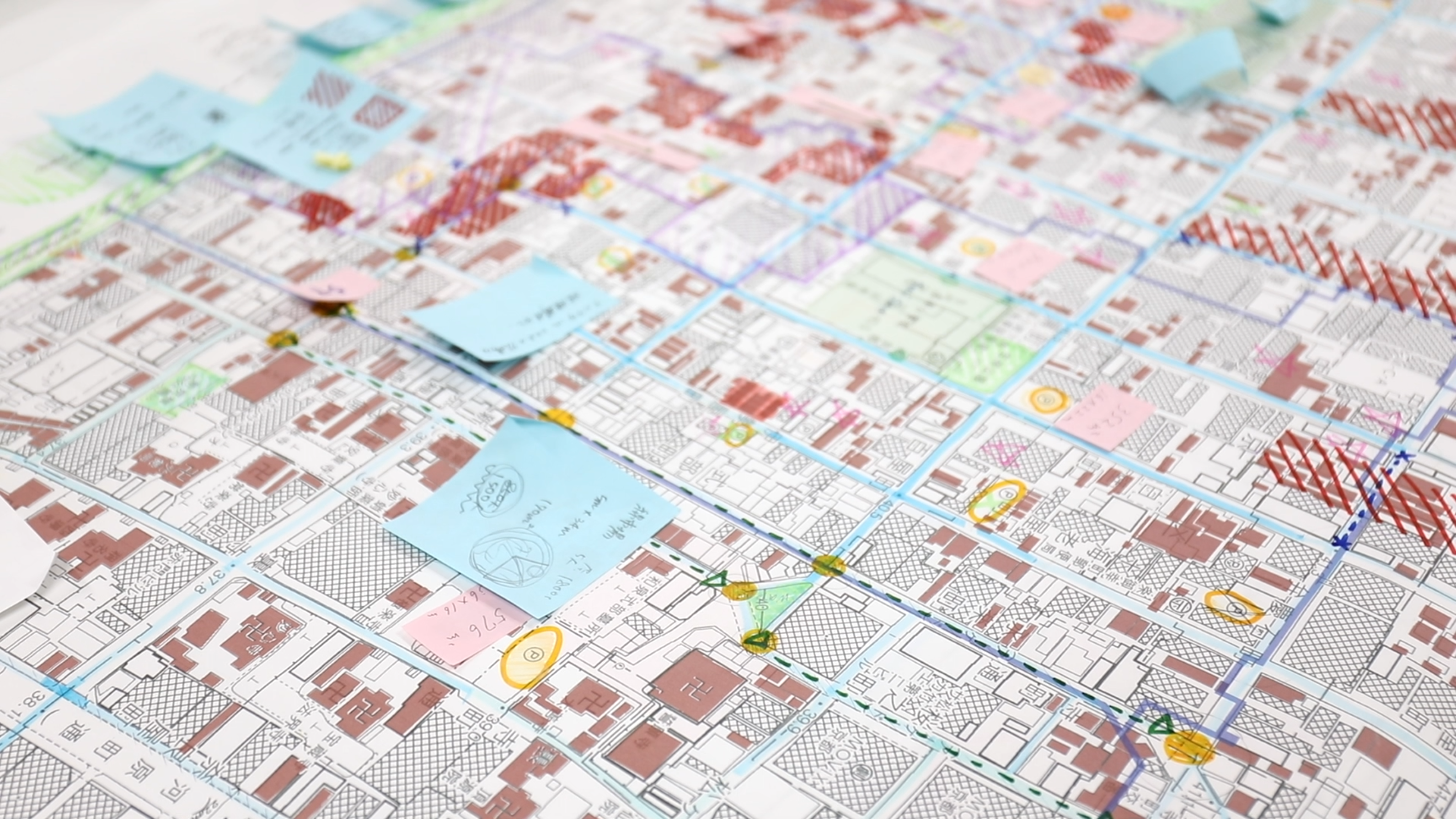
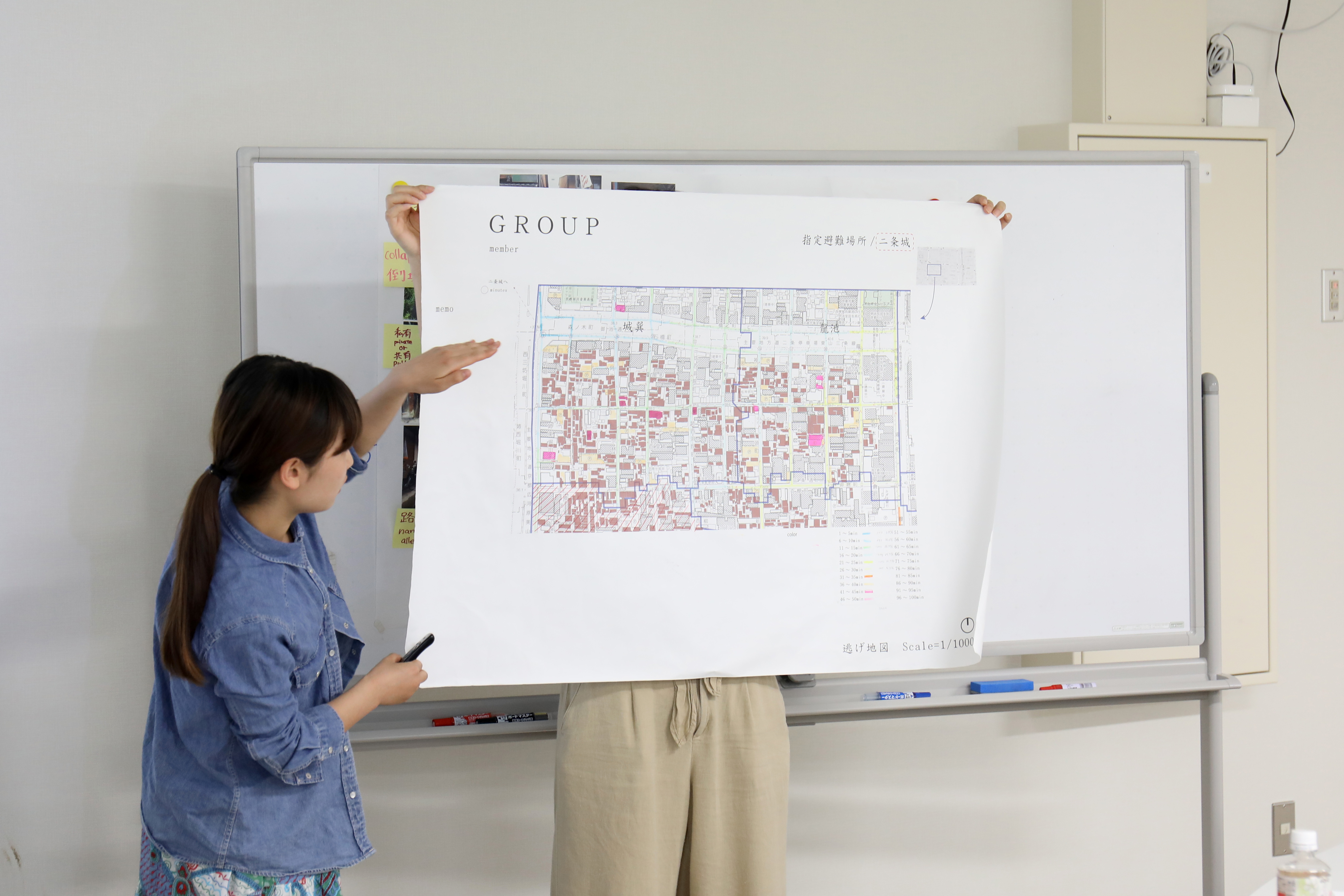
地図を使ったプレゼンテーションの様子
新たな境界線を引き直す
災害というテーマのもと、建築や都市と間接的に関係する、避難時における避難場所での高齢者や障害者の看護・介護や避難時のトイレ問題など多くの問題を孕む水関係の問題をともに議論することができた。また、外国人観光客という視点から都市を考察することで、国際的な観光都市化に伴い増加傾向にある、文化も言葉も違う他者との共生方法を考える契機となった。今後、災害大国として拒むことのできない未来に向け、私たち建築を学ぶものとして何をしていかなければならないのか。何ができるのか。今回のワークショップを通して、建築にはあまり縁のない分野と思い込んでいた学問や局面との関係性や近接性を見出せたことはとても大きな出来事であった。それを踏まえて今後、私と世界の境界線を具体的に引きなおす作業が必要ではないかと感じた。その上で、私たちが建築や都市、デザインの文脈からできることを考えたい。
ライター紹介:三木裕介
京都工芸繊維大学 デザイン・建築学課程 阪田弘一研究室 B4
─外国人観光客の大震災時シナリオライティング
日程|2017年7月5日[水]-7日[金]
会場|京都工芸繊維大学 15号館3階304
ワークショップリーダー|
サミュエル・ボネ [国際赤十字委員会]
ゲスト講師|
小川里美 [日本赤十字九州国際看護大学]
西村文武 [京都大学大学院工学研究科水環境工学分野]
藤原 拓 [高知大学教育研究部自然科学系農学部門]
コーディネーター|阪田弘一 [京都工芸繊維大学 KYOTO Design Lab]
On July of 2017, KYOTO Design Lab has welcomed Mr. Samuel Bonnet, who has been devoting himself for humanitarian aid through the constructions of medical and educational facilities, and conducted a scenario writing workshop for the purpose of disaster prevention in central Kyoto. What problems arise as Kyoto sees a continuous increase in the number of foreign tourists? Furthermore, how do we overcome these problems? Here, we introduce a report written by Yusuke Miki, an undergraduate student of KIT, as well as a participant of this workshop that has undertaken interdisciplinary problems.
Text:Yusuke Miki
Embarking on New Disaster Measures
It has been 6 years since the Great East Japan Earthquake of 2011. While our memory of the earthquake fades day by day, Nankai Trough earthquake is expected to happen in the near future. Furthermore, it is pointed out that we need to draw up a plan about the relationship between cities and natural disasters that are caused by extreme weather such as a sudden downpour. Kyoto is one of the most prominent tourist attractions in the world, and it is visited by many foreign tourists. Although Kyoto is unique in its historical wooden buildings and the long, narrow streets spreading all over when turning at a corner of a main street, these characteristics can potentially be dangerous at the time of natural disaster.
For the purpose of considering the possible disaster measures in Kyoto, KYOTO Design Lab has welcomed Samuel Bonnet, who belongs to International Committee of Red Cross, and conducted a scenario writing workshop. The scenario imagined here is where a foreign tourist becomes very vulnerable due to his or her inability to speak Japanese when a huge earthquake hits Kyoto.
The five-day workshop from July 3rd to July 7th also encouraged discussions from diversified standpoints with diverse lecturers, such as Associate Professor Satomi Ogawa, who teaches at Japan Red Cross Kyushu International College of Nursing, Professor Taku Fujiwara, who teaches at agricultural unit of Kochi University, and Professor Fumitake Nishimura, who researches on hydrological environment engineering at Kyoto University. Furthermore, the participation of a Thai exchange student who belongs to Fujiwara laboratory has provided the group with a perspective of a foreign tourist.

Mr. Bonnet used to be the leader of design and construction team in International Committee of Red Cross. The team designed medical facilities in disputed areas such as Kosovo.
Hands-on Workshop and Fieldwork
The first and second day of the workshop has been spent on creating a Run and Escape Map that compares routes and time required for evacuating to a designated evacuation area in the neighborhood. Run and Escape Map was invented by the volunteer team of Nikken Sekkei as a method of simulating evacuation routes and evacuation times on a map. We color-coded the map according to the time required for arriving at a designated evacuation area on foot. Although we were surprised by the characteristics of each area coming to light by this simulation, we were even more surprised by the diversity within a city when we conducted a fieldwork. A map does not capture the small undulations on the roads or the potted plants placed on the side of the streets. In fact, an accumulation of diverse details with diverse materials and sizes comprises a city as a whole. It helped us generate a concrete proposal when each group measured the dimensions of the roads and buildings, and then, added pictures and insights on the map.
Furthermore, we also learned from Mr. Bonnet’s lecture that medical facilities in the disputed regions tend to reuse an existing building and prepares a minimum necessary amount of medical equipment with the greatest amount of consideration for the region. Although strife and natural disaster are two separate phenomena, we learned a great deal for they both share the theme of urgency.

Scene from the fieldwork that took place in a light rainfall.

Mr. Samuel Bonnet (left) and Ms. Satomi Ogawa (right) introducing the projects of International Committee of the Red Cross
Ideas Are Inspired by What We Already Have
In the final presentation, each group presented their proposal on the safe and quick evacuation guidance. One group proposed the plan and the design where the rooftop and parking area of the existing shopping mall becomes evacuation area. Another group proposed to have the public transportation system such as buses and taxis function as an information center with temporary emergency exit signs. Other proposals included a smartphone app that lets users check the routes and time needed for evacuation and Illuminated exit signs that detect the earthquake.
What most proposals had in common was to use what already exists in the city and prompt a guidance that communicates well with anyone. During the critique session, the guest lecturers pointed out that the existing elements blend in the city very well already, and therefore, might be able to be clearly identified by people. Furthermore, they added that the idea of using public transportation systems to facilitate evacuation should be developed more in depth from now on since it can be implemented rather easily. Professor Fujiwara and Professor Ono, the Chief Executive Office of D-lab as well as the chairman of Japan Society of Water Environment, have further reminded us about the issue of securing domestic water at the time of disaster. Although each group had already discussed on securing water for drinking, bath and toilet, the central Kyoto with its wooden buildings also requires water for extinguishing fires. Although this is relatively unknown, Kyoto sees the decline of well water despite its rich groundwater. Therefore, the discussion also extended over how to revive the community once fostered by well water.


Scene from the presentation using a map
Redrawing the Borders
Under the theme of disaster, we discussed the various water-related issues such as that of caring for the senior citizens and people with disabilities, and of providing restrooms. Moreover, by analyzing the city through the perspective of foreign tourists, we had a great opportunity to ponder how to coexist with those who speak a foreign language and have a foreign cultural background. This experience also made me wonder what an architecture student can do for the future of this nation with many earthquakes. Given that I realized how architecture is indeed related to many other seemingly unrelated fields of study, I felt that the next step would be to redraw the border between me and the surrounding world. When this step is completed, I would like to, again, think about what I can do in the context of architecture, city and design.
Author:Yusuke Miki
Kyoto Institute of Technology, Design and Architecture, Koichi Sakata Laboratory B4
Date|July 5th (W) – July 7th (F)
Location|Kyoto Institute of Technology, Building 15, Room 304
Workshop Leader|
Samuel Bonet [International Committee of the Red Cross]
Guest Lecturers|
Satomi Ogawa [Japan Red Cross Kyushu International College of Nursing]
Fumitake Nishimura [Kyoto University, Graduate School of Engineering, Water Quality Engineering]
Taku Fujiwara [Kochi University, Research and Education Faculty, Natural Sciences Cluster, Agriculture Unit]
Coordinator|Koichi Sakata [Kyoto Institute of Technology, KYOTO Design Lab]